"Here are the rocks, layers over layers, monuments of solitary tenacity that comfort the hearts of men."
(Dino Campana, Canti Orfici)
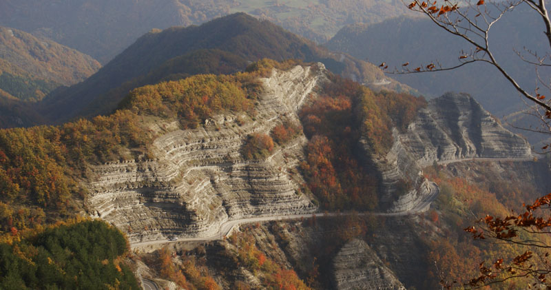
The territory of the National Park is characterized by a rather homogeneous geological structure on the Romagna side (Romagnola Succession - Marnoso-Arenacea formation) and more diversified in the Tuscan side (Successione Toscana - Scaglia Toscana, Sandstones of Monte Falterona and Marne di Vicchio).
However, all the rocky outcrops that we encounter, as well as any peculiar shapes in the landscape, preserve a testimony of the Earth's past. Along the paths and roads of the Park geology is revealed in many places: layers that barely glimpse in the forests or emerge clearly along the barest ridges, waterfalls that run for tens of metres smoothing the rocks, landslides that open tears in the slopes, up to the massive and solitary cliff of La Verna, where rocks that are very resistant to erosion are supported by clay rocks.
In 1997-98, thanks to a scholarship, a census was carried out of the Park geosites, i.e. geological or geomorphological emergence of scientific, environmental, and landscape value. Thanks to this work, updated in the following years by the Geological, Seismic, and Soil Service of the Emilia Romagna Region, 86 sites have been identified, 60 of which are located within the Park boundaries: natural cavities, cliffs with drip water, sunny outcrops embellished by the presence of cliff flora, but also waterfalls and stagnations of water, which deserve forms of protection as places of reproduction for animal and plant species of conservation interest.
»Discover the geosites of the Park on the webgis
»Discover all the geosites of the Emilia-Romagna Region
Here are some of the most interesting geosites of the Park:
» Waterfall and Valley of Acquacheta
» Monte Penna - Rupe della Verna