Those who venture along the paths of the National Park can find a wide choice of routes, with different lengths, degrees of difficulty, and natural environments. Over the years, the Park has made available a series of tools for hikers that make it easier to travel: from signage to hiking maps and other publications dedicated to hiking.
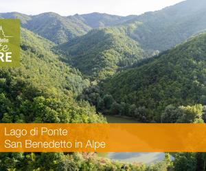
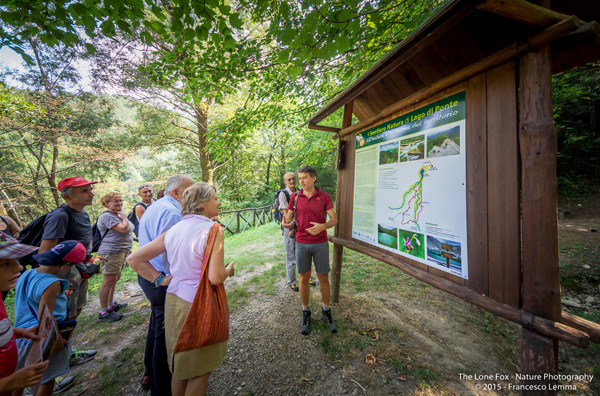
Among the various proposals are the "Nature Trails": special paths, easy to travel, along which there are stopping points for environmental observation and interpretation, ranging from purely naturalistic to historical and cultural aspects. The first Nature Trails were created a few years after the establishment of the National Park, with the intention of promoting routes suitable for those who had no particular experience in hiking and accompanied by points of environmental interpretation, located in the most important places in the area: from Lago di Ponte (Tredozio) to La Verna, passing through Fiumicello (Premilcuore), Campigna, Ridracoli, Castagno d'Andrea, Badia Prataglia and Camaldoli. Also, some of these have been updated from the point of view of contents, also positioning new displays along the route. These works have so far involved the Nature Trails of Ridracoli, Fiumicello, Acquacheta, and Lago di Ponte and in future will also be applied to the remaining paths.
Recently, an App dedicated to the 9 Nature Trails of the Park has been created and put online, in order to have all the necessary information to follow the paths: from the map of the route to the technical information on length, height difference, and travel times, all accompanied by detailed descriptions of all the points of interpretation that can be encountered along the itinerary.